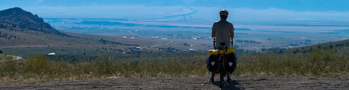
Chiggiogna, Switzerland to Attinghausen, Switzerland
Today was challenging, but in a different way than I expected. The climbing was tough, but the frustration came with road closures that allowed me to get close to Gotthard Pass but not let me reach the summit. I had to make up a plan B on the fly about 4 hours into my ride. I did however challenge myself with some climbing in the Alps and make it to an end point for the day that I am happy with, so all was not lost.
The day started with packing up camp at the campsite in Chiggiogna. I woke up around 7:00 and found it very hard to get out of bed. It was under 50 degrees and I knew as soon as I unzipped my tent all the heat would escape. I’ve changed up my gear for this tour to save some space and have ditched my 3 season sleeping bag for a lightweight down quilt and a sleeping bag liner. I knew with affordable hostels everywhere I would camp less this trip and my sleeping bag is almost too warm to sleep in during a normal summer night. The trip into the Alps was the one instance where I thought my gear wouldn’t be warm enough. It did the job for the night, but I didn’t want to leave the warmth of my bed.
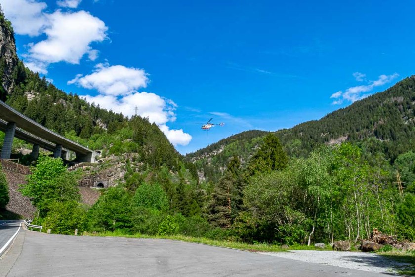
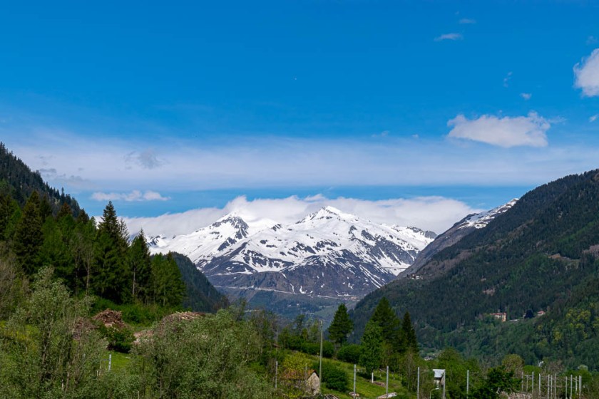
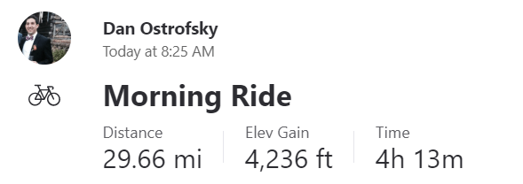
By 7:30 I was up and moving and I was on the road by 8:25. I headed 1 mile up the road to the town of Faido where I stopped at the grocery store to pick up breakfast and a sandwich for lunch. The next 3.5 miles were hard, but I did have a nice view of a helicopter plucking tree limbs from the side of the mountain which kept me interested.
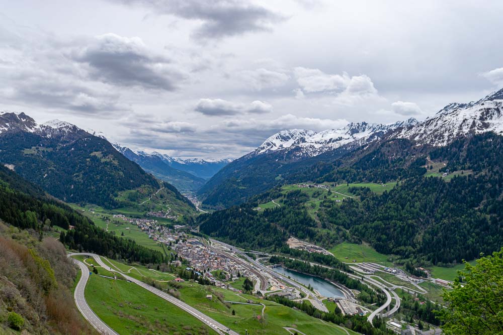
The climb then steadied to a consistent grade all the way to the town of Airolo around mile 12.5. For those miles I had a nice view of the mountain I would be climbing up later in the day. I stopped in Airolo for a quick pastry and coke to top me off on calories, hoping it would allow me to make it to the top of Gotthard Pass without stopping to eat.
From what I can tell there are 3 options to get from Airolo to Göschenen on the other side of the mountain. There is a 10.5 mile long tunnel that goes under the mountain, there is a road for cars that goes over the pass, and there is a route meant for cyclists and hikers. I opted for the cycling route and started making my climb up the many switchbacks. Airolo sits at 3,855 feet elevation and Gotthard Pass is at 6,909 feet, so it’s a lot of elevation gain over 8 miles of riding. The switchbacks were tough and included long sections of cobblestone which only made the climbing harder. I stuck with my plan of keeping things slow and steady and within an hour and a half I had made steady progress all the way up to 5,600 feet. At this point I saw a gate blocking the road which got me concerned. Once I had gotten to 5,000 feet, I was above the snow line and the snow started encroaching on the road. I went under the gate and walked an additional .25 miles at which point the road was completely blocked by snow. I was going to have to turn back.
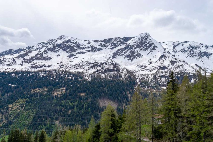
I backtracked about a mile and was able to take a small service road to connect me from the cyclist route to the car route. I had to lift my bike over a siderail for the main road but was able to start climbing again. I climbed another 3.5 miles and reached a short tunnel at 6,300 feet. Once through the tunnel I would be .75 miles from Gotthard Pass, and it would be all downhill from there. In the tunnel I was stopped by a worker who told me the road ahead was not safe and there was danger of avalanche. I had to turn around at 6,550 feet, under 300 feet from the top of the mountain.
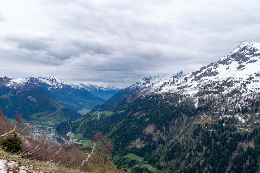
Knowing I was blocked from making it to the top via both available routes I had to make new plans. I headed back down to Airolo where there is a train station and found I could get to the other side of the mountain by train. I quickly found a cheap hotel about 5 miles from the train station in Erstfeld and then got train tickets for myself and my bike to travel from Airolo to Erstfeld. I was disappointed to not have made it to the top but more disappointed that I had made the mistake of attempting a climb that couldn’t have been completed. I’m not sure how I would have known the pass was closed. I either missed signage because it wasn’t in English or was paying more attention to getting in the groove of climbing instead of the signs on the road.
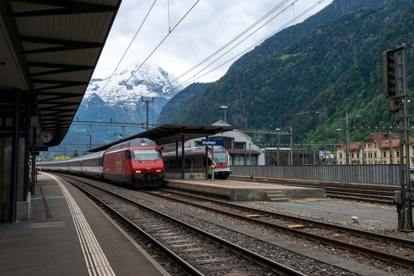
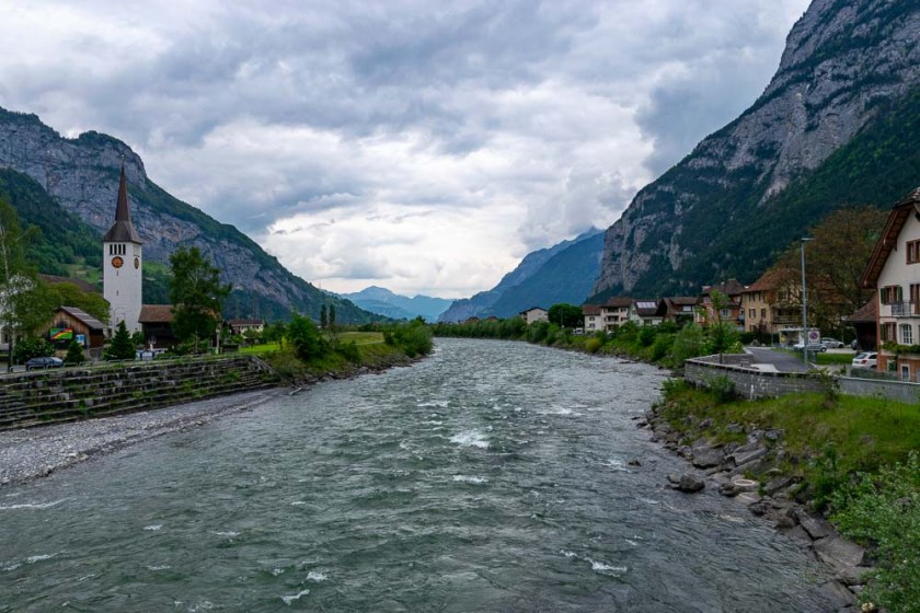
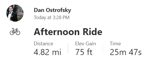
I sat down at the train station and started to eat my sandwich when Jacqueline, a fellow cyclist, started a conversation with me. Jacqueline is an extremely experienced bicycle tourer having previously ridden from England to Thailand among many other trips. It was really nice to have a conversation with someone who could understand what I had gone through and she helped me reframe the day. Jacqueline had done the climb to Gotthard Pass before and said when the pass is open the cars are very aggressive making the cycling not all that enjoyable. She said I should be thankful I got to basically do the entire climb and not have any cars on the road. This made me feel better and I think I still accomplished my goal of challenging myself in the Alps by basically do the entire climb. All I missed out on was the fun downhill on the other side. The train ride was quick and before I knew it, I had arrived in Erstfeld at 1,500 feet elevation. It would have been nice to ride from 6,900 feet all the way down to Erstfeld, but I did get a big downhill from the top of the mountain back to Airolo. From the Erstfeld train station it was a quick 5 miles to the hotel I had booked. This placed me about 15 miles ahead of where I had originally planned to stop and means I’ll have a short ride to Lucerne tomorrow. I’ve had a bunch of short mileage days in a row, but I’ll be able to start pushing longer days again after I take a few days of rest in Basel.
Musings:
- I think I’m going to start having communication issues again. Gotthard Pass marks the border between the Ticino region where the Swiss speak Italian and the Uri region where they speak German. I know absolutely no German. I didn’t know Italian either, but I’ve gotten good enough to get through the day. I’m hoping I figure this out quickly, but I’ll be in France next week so I’m not sure I’ll get in any sort of rhythm with speaking German. If anything, I am greatly improving my Charades skills.

You’ll come back as a pro at salad bowl!
LikeLike
It was great to meet you, Dan! I’m happy our chance encounter was fruitful! There is a large red sign saying closed in several languages at the foot of the Gotthard however when you are head down slowly turning the pedals it would be easily miss! http://www.alpenpasse.ch is the place to see if Swiss mountain passes are open. Enjoy Lucerne…don’t miss the bridge!
LikeLike